Geospatial
Technology is revolutionizing and transforming geospatial data. Geographic information systems (GIS) manage, store, and integrate vast amounts of geospatial data, creating a dynamic repository of information that’s updated daily. Knowing how to leverage this data can make all the difference in your transportation asset management program.
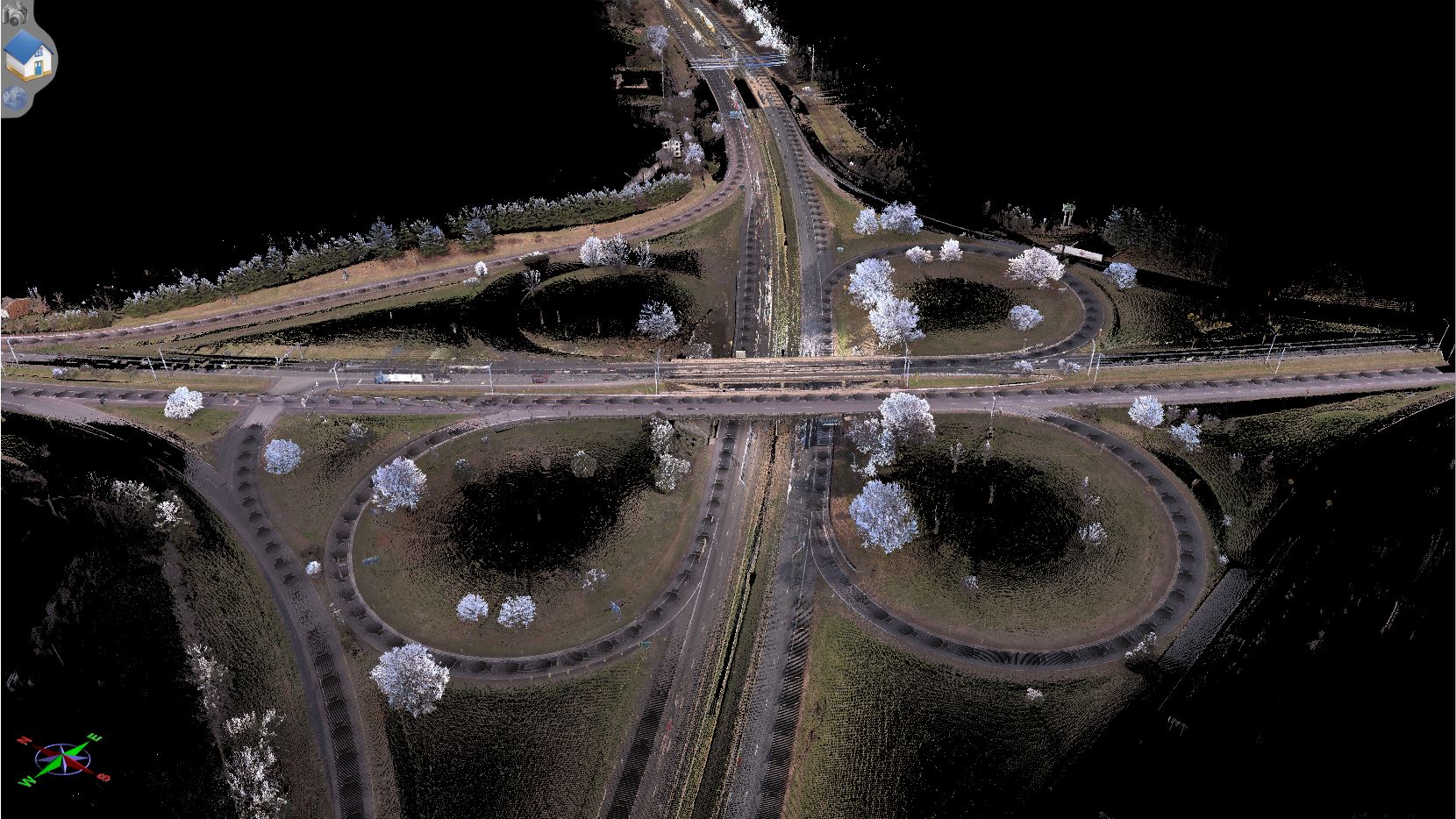

What is Geospatial?
An object or location that has a geographic component and is identified in terms of coordinates is geospatial. Often this data is gathered by GPS, satellite imagery, demographics, statistics, road networks, historical maps, investigation, and LiDAR. The data set is impressive, but knowing what to do with it can be overwhelming. That’s why you need an experienced partner who can help.

Why You Need a Geospatial Asset Inventory
Does having a global and granular view of your assets and their condition sound impossible? Geospatial asset inventories make it possible—giving you a full-scale understanding of your assets from location to condition so you can make data-driven decisions. With a geospatial asset inventory, you’ll be able to:
- Use the data for many functions including O&M, emergency, financial, development & planning, and compliance
- Save time and money by collecting data in hours rather than months
- Observe conditions and assets remotely increasing worker safety while saving time, money, resources, and energy.
Share data with collaborators and integrate existing data into your system
Get Solutions Tailored to Your Needs with PILLAR
PILLAR has helped DOTs all over the country evaluate their existing geospatial data and strengthen their digital assets through our geospatial solutions. Want a solution developed specifically for your requirements? Contact us to learn how we can help.

Related Projects

Effectively Scope Mowing Acreage
Leverage Data to Stop Mowing Scope Creep

Existing Conditions for Bid Evaluation
462-Mile Project Review Stymies Competitive DOT Proposal

GIS Inventory Review
Don’t Let Your Data Go to Waste

Inventory Mapping and Drainage Assessment
Unusable Data Leaves Asset Maintenance Blocked
Let’s Talk
Complete the form below to start a conversation with PILLAR.