Automated Feature Extraction
Access to high-quality data is essential to maintaining the integrity of your transportation assets, but ensuring your data is ready to use can be time-consuming and frustrating. PILLAR’s proprietary automated feature extraction system (AFES™) delivers a truly automated solution. Stop losing hours to formatting data, scrolling through overlapping pictures on your point cloud identifying, clicking, and linking assets.
Save Time and Money with Fully Automated Feature Extraction
Access to high-quality data is essential to maintaining the integrity of your transportation assets, but ensuring your data is ready to use can be time-consuming and frustrating. PILLAR’s proprietary automated feature extraction system (AFES™) delivers a truly automated solution. Stop losing hours to formatting data, scrolling through overlapping pictures on your point cloud identifying, clicking, and linking assets.
Collect Data Faster with Next-Generation Geospatial Technology
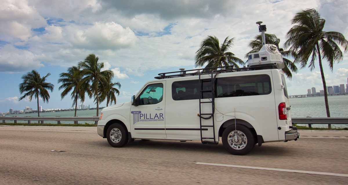
Our Leica Pegasus: Two Ultimate imagery scanning technology powers data collection at highway speeds to give you an impressive and detailed understanding at the street level. Our technology includes:
- 360-degree spherical
- 6 – 5 MP cameras – 30 MP
- Drone aerial collection
- Faster data collection: laser collection at posted speed limits enables the ability to scale.
- Street-level imagery: snapshots of roadways during data collection.
- Global view of infrastructure assets
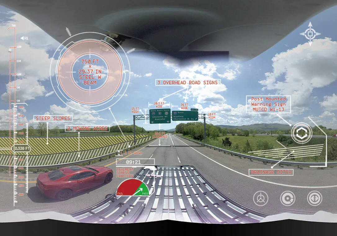
Extract Features Instantly So You Can Get to Work
Our AFES saves up to ten times the money and time of traditional point-and-click extraction methods. We use machine learning, artificial intelligence, and computer vision to process your data as it is gathered. Our technology extracts more than 20 asset types from mobile LiDAR data, including but not limited to:
- Signs
- Bridge Clearances
- Ditches
- Guardrails
- Mowing Acreage
- Overhead Utilities
- Trees
- Striping
Save 10x Time & Money
Our AFES saves up to ten times the money and time of traditional point-and-click extraction methods. We use machine learning, artificial intelligence, and computer vision to process your data as it is gathered. Our technology extracts more than 20 asset types from mobile LiDAR data, including but not limited to:
Related Projects

Inventory Mapping and Assessment
Overwhelming Inventory Needs Threaten Timely Asset Management in Bristol, VA

Inventory Mapping & Assessment
Overwhelming Inventory Needs Threaten Timely Asset Management in Salem, VA

GIS Inventory Review
Don’t Let Your Data Go to Waste

Pedestrian Path Assessment & Maintenance Management
Assess Don’t Guess When It Comes to Cyclist and Pedestrian Safety
Let’s Talk
Complete the form below to start a conversation with PILLAR.