Avoid Invasive Data Collection and Protect Wildlife with Mobile LiDAR
Minimally Invasive Data Collection

Problem
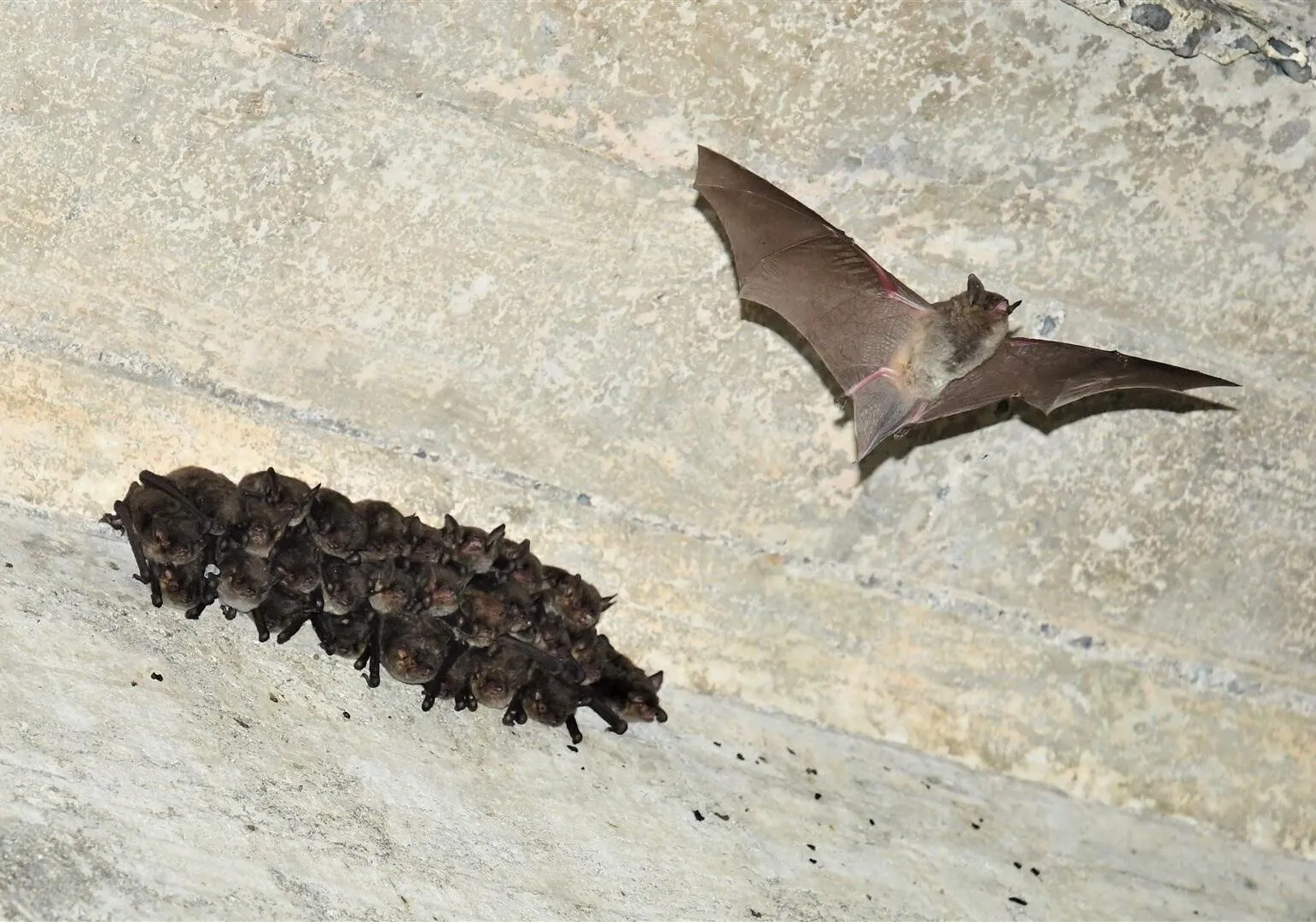
VDOT needed to collect data on a specific bridge quickly and with minimal disturbance to assess the different construction methods utilized over the years and determine appropriate repair methods to prevent failure. They also had a secondary goal to match the culverts and walls beneath the bridge with street level. VA DGIF oversaw the project, and they faced two major obstacles to obtaining data: 1) a colony of endangered Indiana Bats lived under the bridge and should be minimally disturbed, and 2) the scan should be completed within a single day.
The team found that even static LiDAR scanning was too slow, intrusive and invasive, and its beams, lasers created shadows that resulted in inaccurate data. They needed an elegant data collection solution that would not disturb the bats.
Solution
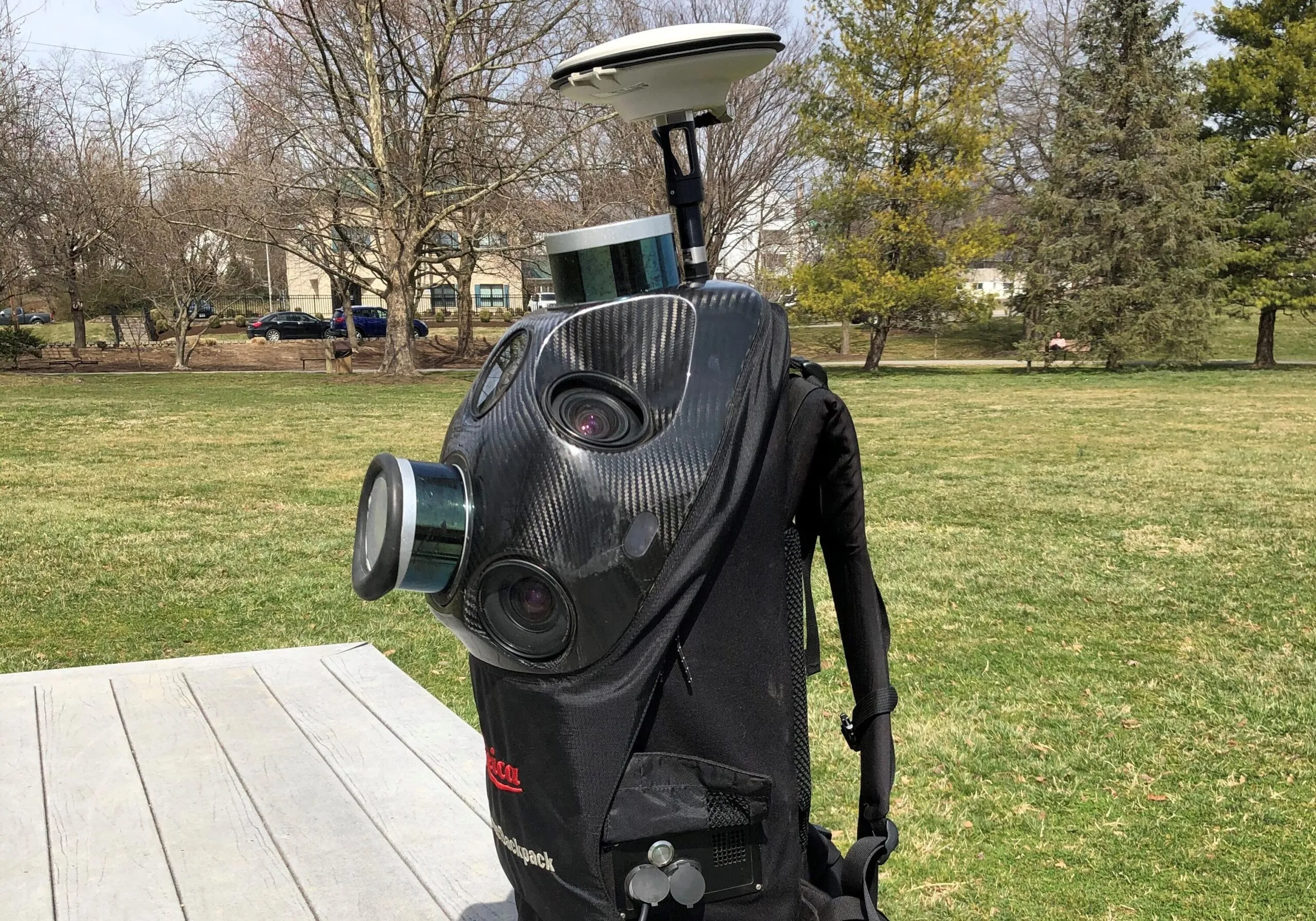
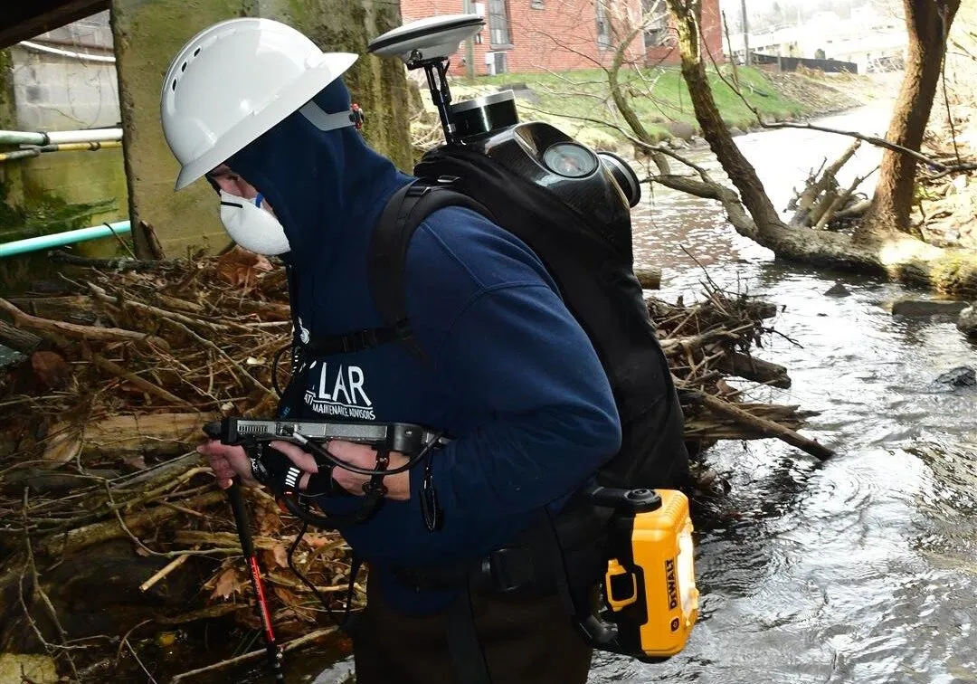
To minimize the disturbance to the endangered Indiana Bat population, the team performed a backpack LiDAR scan of the 1,320 ft wide 3-span Piedmont Ave Bridge in Bristol, VA, in one day during the annual permitted 2-week window. Furthermore, they overcame the lack of GPS signal and technical hurdles of overlaying and matching street grade LiDAR through position correction routines and procedures.
Approach
PILLAR performed an underground LiDAR scan capturing georeferenced point clouds and pictures for project planning. The project was coordinated to be completed in a single day within an annual permitted 2-week window to minimize disturbances to the bat population living under the bridge.
The bridge is a 3-span structure with a live stream running through it. Over the years, it was widened to an approximate width of ¼ mile–making it a confined space–using various design and construction elements. Very little records were kept regarding work to the bridge and the bridge’s rating has fallen to the point that it required repairs.
PILLAR utilized a backpack LiDAR scanning unit to obtain a 3D Map of Piedmont Bridge. This entailed capturing geo-referenced, time-stamped point clouds and corresponding photographs to map under the bridge along with an above ground scan of the area surrounding the structure. The crew made multiple passes with the scanner enabling the scanners to collect data between girders and beams as well as eliminate any shadows cast by piers or other obstructions. The geo-referenced LiDAR and digital imaging data was post-processed using system specific computer software and proprietary programs for use in repair design.
Let's Talk
Complete the form below to start a conversation with PILLAR.