Overwhelming Inventory Needs Threaten Timely Asset Management in Bristol, VA
Inventory Mapping and Assessment

Problem
When the VDOT Bristol District took back the maintenance of their interstates from a private maintenance service provider, they needed to obtain a current assessed inventory of 130 centerline miles for budgeting, planning, and contracting purposes.
Solution
Pillar quickly assessed the assets in a manner consistent with the state’s Maintenance Rating Program (MRP) and utilized InfraTrak to help digitally monitor work to and condition of the assets.
Approach
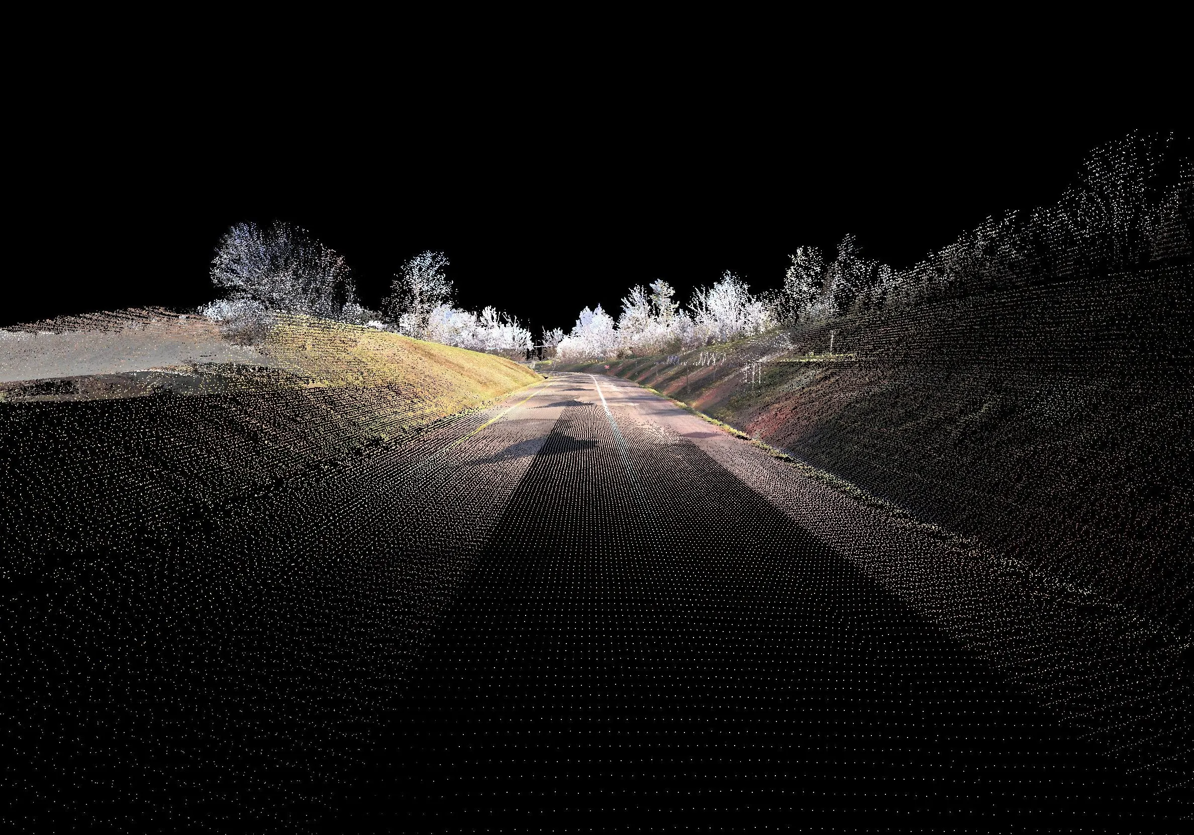
PILLAR rented a mobile LiDAR scanner to obtain a 3D map of the desired corridor. The map included point cloud and imagery of the roadside features. Spherical images were captured every 10’ of traveled pathway.
For single lane roads and double lane roads (one lane in each direction), a PILLAR unit made one pass in each travel direction. For quadruple lanes or more, the unit made one pass on the outside lane or shoulder and another pass on the inside lane or shoulder wherever possible. This extra step enabled the scanners to scan over the banks into the ditches as well as obtain photos over the banks or where not covered by vegetation.
From the post-processing, PILLAR identified and labeled asset features and imported them into GIS software.
Once we obtained the images and point clouds, PILLAR pros created the inventory database, performed condition assessments, and verified asset attributes for assets on I-81, I-381, and I-77 including ramps. Our experts recorded detailed assessment descriptions to easily determine work load, budgeting, contract, development, and more.
PILLAR delivered a ready-to-view, electronic database file to the client using Spatial Factory along with an ArcView database file. Each asset was identified with a unique ID number, attributes correlating to asset type, mile marker, direction, offset from lane, GPS coordinates, condition, and photo.
Let's Talk
Complete the form below to start a conversation with PILLAR.