Unquantified Pollinator Programs Could Leave Millions on the Table for DOTs
LiDAR – Chesapeake Bay TMLD Interstate Scanning

Problem
One DOT was required to address harmful roadway runoff in the Chesapeake Bay watershed by purchasing nitrogen credits. In order to qualify for a reduction in required nitrogen credit purchases and demonstrate the efficacy of their mitigation programs, the DOT needed to measure the exact acreage of impervious pavement and gather precise data of pervious areas over 775 miles of interstate.
Solution
Through highly precise data collection, extraction, and analysis, PILLAR saved the DOT $12.8 million in mitigation projects and nitrogen credit purchases.
Approach
In the Chesapeake Bay watershed, stormwater runoff full of nitrogen and phosphorus fueled algae growth and reduced the amount of available oxygen to marine life. Through an DEQU MS4 permit, a DOT converted hundreds of acres of pervious areas within its right-of-ways into pollinator environments, naturally mitigating nitrogen through the root systems of plants and changing the amount of nitrogen in runoff.
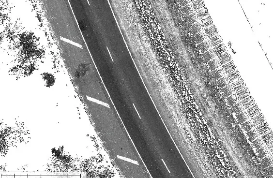
To help the DOT determine the new stormwater runoff characteristics within their watershed and qualify for a reduction in nitrogen credit purchases, PILLAR acted as a subcontractor. We utilized our Mobile Terrestrial LiDAR Scanning (MTLS) system to collect point cloud data and spherical imagery and georeferenced plan sheets to delineate the state property limits.
PILLAR then utilized our automatic feature extraction system to extract, classify and calculate various types of assets and identify impervious, and pervious ground classifications. This was important because the impervious areas created the need to buy credits while the pervious areas offset the need.
Once we classified the terrain into impervious and pervious, we needed to analyze the pervious terrain at a granular level to understand its characteristics. For example, we identified whether the terrain was a mowed, forested or pollinator habitat. These characteristics create different runoff coefficients which impact calculations.
PILLAR was able to analyze terrain at a very high level of detail, reporting on pavement, stone shoulders, guardrail, steep slopes, trees, fence, bridges and signs and even what areas required hand mowing. The data enabled the DOT to apply the correct run-off coefficient value, calculate their runoff volumes with precision and qualify for a $12.8 million reduction in nitrogen credits.
Let's Talk
Complete the form below to start a conversation with PILLAR.
